Most viewed - Danny Yates
|
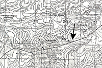
DY-31b.JPGThen and Now79 viewsShortly before we left, my wife discovered an old map I
had ordered many years ago. On the map (see above) the
airstrip that was clearly marked next to the highway. That runway was just
across the road from my tent. Notice the notch in tea plantation below the airstrip.
|
|

Yates.JPGModern Day Danny79 viewsModern-Day Danny attending our historic 2/9th Reunion at Ft Sill, OK in May-June 2013.
|
|
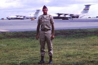
IMGA1.jpgYep...I made it home79 viewsArrived at Travis AFB, ending my luxurious tour of Vietnam. When you enlarge this photo, you will see the tail number of the C-141 that flew me home.
|
|
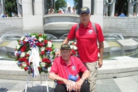
WWII_Memorial.jpgHonor Flight79 viewsLaying of a wreath at the WWII Memorial in Washington, DC during the weekend of June, 2015, 71 years after the D-Day landing.
|
|
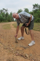
DY-Nam.jpgBack in Nam again78 viewsDanny is walking along the road in the former LZ Uplift area and is picking up a piece of a sandbag in the roadway.
|
|
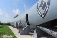
IMG_6137.jpgFound my Freedom Bird!78 viewsWith a lot of help from an ex-C-141 pilot, I was able to track down and
reunite with the plane that brought me home from Vietnam. I just happened
to have one picture of me with the plane, and I was able to use the tail
number to find my plane.
|
|
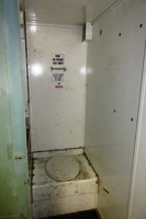
IMG_3882.jpgFound my Freedom Bird!78 viewsThankfully, I didn't have to use the can. It beats a 55-gallon drum, though. Maybe the dogs used this one.
|
|
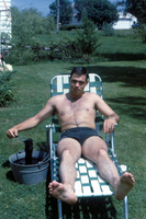
OD_Underwear.JPGOlive Drab Underwear77 viewsWell, I wasn't issued any OD underwear, so I had to "make" my own by dipping some in green dye prior to departing for Nam. Many of us, if not all, did not know what to pack for Vietnam.
|
|
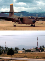
DY-28.jpgThen and Now76 viewsHere is a comparison picture of the airstrip in Duc Pho. I wasn't able to make an exact comparison because I couldn't get to the other side of the runway, as it is a restricted area, but it is close enough to see how the area has changed. {However, the background is unmistakable!)
|
|
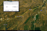
DY-31c.JPGThen and Now76 viewsNext, I went on Google Earth to look at that location. In this screen print, you can find the same notch. I then used the mileage feature on Google Earth to measure the exact distance from that location back to the intersection where Hwy 19 and Hwy 14 split. I showed that picture to our driver so he could measure the distance on the odometer. Again, it's not a dramatic comparison, but the topography is the same. I
had a lot of fun just preparing for the trip.
|
|
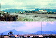
DY-32.JPGThen & Now: the search for Base Camp75 viewsOne of my goals on this trip was to find the location of the 2/9th base camp we had when I arrived in country in July, 1966. The first bit of evidence came when I found a picture online taken several years after we were there, and the person identified the picture as Engineer Hill. But I still didn't know where exactly that was.
{See also: War Stories - Base Camp}
|
|
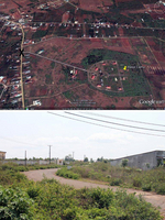
DY-32e.JPGThen & Now: the search for Base Camp75 viewsOur guide pointed out this road leading into our base camp area. Something about that looked awfully familiar. I've attached the picture along with a Google Earth screen print, marked with an "x" to show where the picture was taken. So close, and yet so far.
According to my letters home, base camp moved to an area south of Pleiku, probably Enari, in May of 1967.
|
|
|
|
